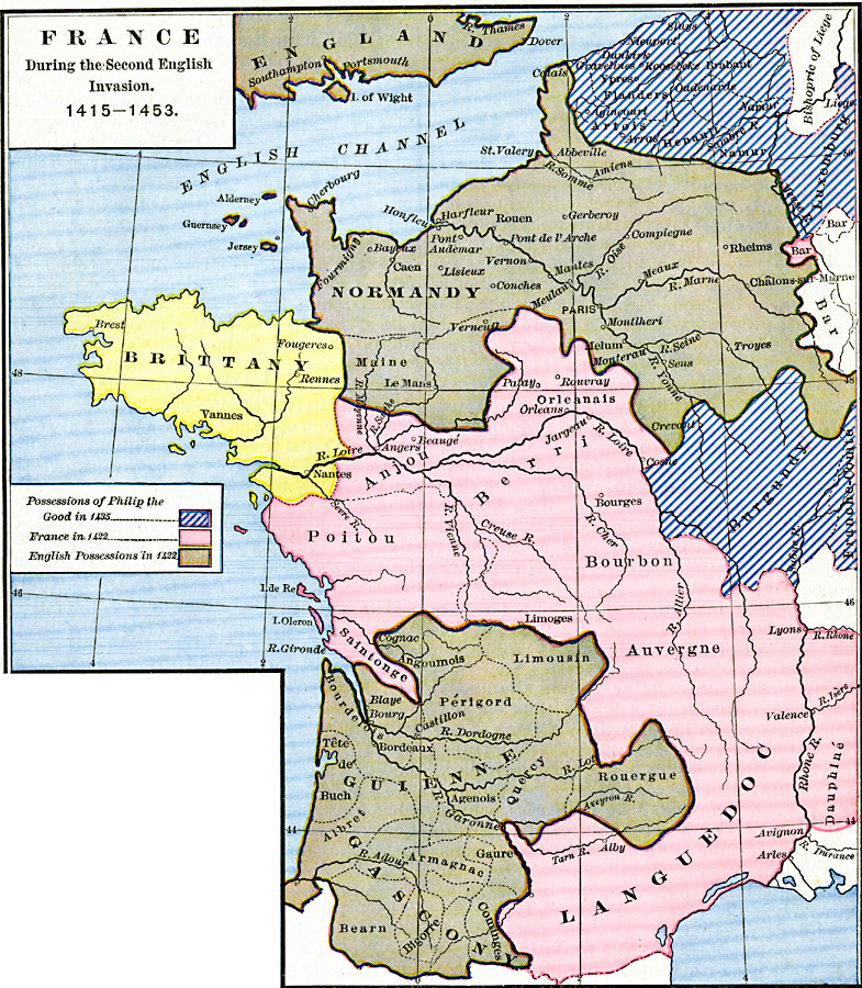
Description: A map of France during the second English invasion during the Hundred Years' War, between the Battle of Agincourt (1415) and the Battle of Castillon (1453). The map is color–coded to show the French and English territories in 1422, the year of the death of both Henry V (England) and Charles VI (France). At that time the English held Normandy in the north and Guienne–Gascony in the southwest, while France held Anjou, Orleanais, Poitou, Berri, Bourbon, Anvergne, Dauphiné, and Languedoc. The map also shows the neutral territory of Brittany, and the Burgundian possessions under Philip the Good in 1435 under the Treaty of Arras, which included Artois, Flanders, Brabant, Henault, Namur, and Luxemburg in the north, Burgundy and Franche–Comte.
Place Names: France, Anjou, �Auvergne, �Berri, �Bourbon, �Brittany, �Gascony, �Guienne, �Languedoc, �Lyons, �Normandy, �Orleans, �Poitou
ISO Topic Categories: oceans,
location,
inlandWaters,
boundaries
Keywords: France during the Second English Invasion, borders, �political, kHundredYearsWar, major political subdivisions, oceans,
location,
inlandWaters,
boundaries, Unknown, 1415–1453
Source: Robert H. Labberton, New Historical Atlas and General History (New York, NY: Townsend MacCoun, 1886) Plate XXXVIII
Map Credit: Courtesy the private collection of Roy Winkelman |
|