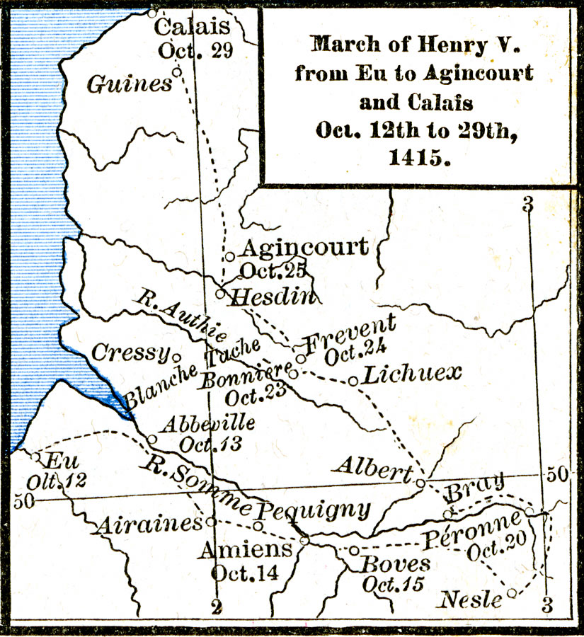
Description: A map of the region in northern France showing the march of Henry V from Eu to Agincourt and Calais, Oct. 12 to 29th, 1415 during the second English invasion of the Hundred Years' War. The map shows the starting point of Henry's march to Calais at Eu, his route taken (with dates) to Agincourt and the famous battle against the French, and the continuation to Calais.
Place Names: France, Agincourt, �Amiens, �Calais, �E
ISO Topic Categories: oceans,
location,
inlandWaters
Keywords: March of Henry V from Eu to Agincourt and Calais, borders, �historical, kHundredYearsWar, other military, oceans,
location,
inlandWaters, Unknown, October 12 to 29th, 1415
Source: Robert H. Labberton, New Historical Atlas and General History (New York, NY: Townsend MacCoun, 1886) Plate XXXVIII
Map Credit: Courtesy the private collection of Roy Winkelman |
|
