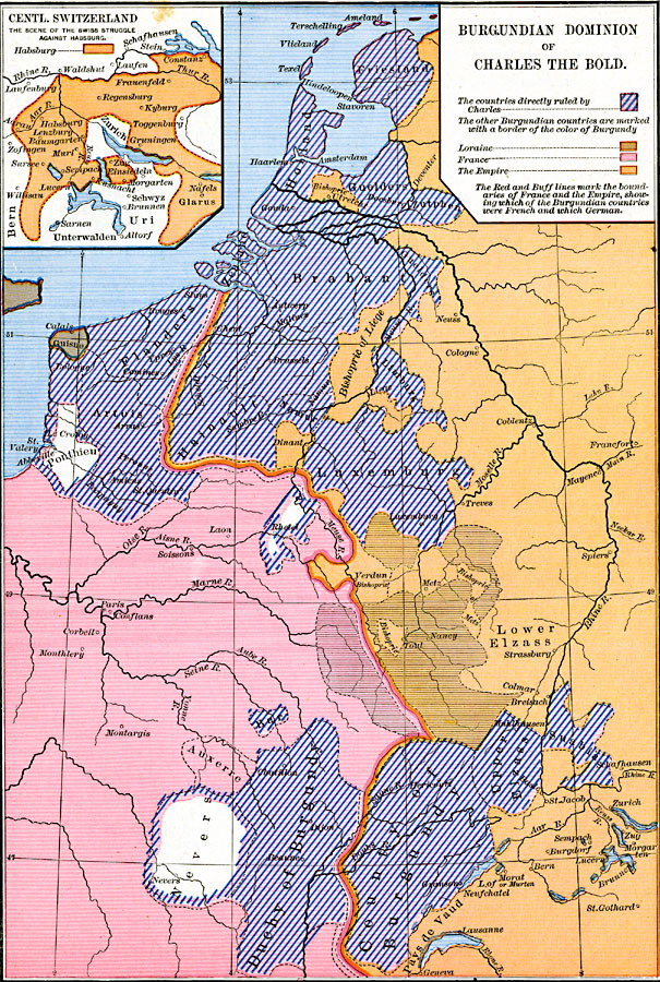
Description: A map of the Burgundian Dominion of Charles the Bold in 1477. The map is color–coded to show countries directly ruled by Charles, as well as land controlled by Loraine, France, and the Empire. The inset map details central Switzerland and the scene of the Swiss struggle against the House of Habsburg.
Place Names: Western Europe, Burgundy, �France, Utrecht, Liege, Luxemburg, Nancy, Duchy of Burgundy, Zurich
ISO Topic Categories: oceans,
location,
inlandWaters,
boundaries
Keywords: Burgundian Dominion of Charles the Bold, borders, �political, country borders, oceans,
location,
inlandWaters,
boundaries, Unknown, 1467–1477
Source: Robert H. Labberton, New Historical Atlas and General History (New York, NY: Townsend MacCoun, 1886) Plate XLI
Map Credit: Courtesy the private collection of Roy Winkelman |
|