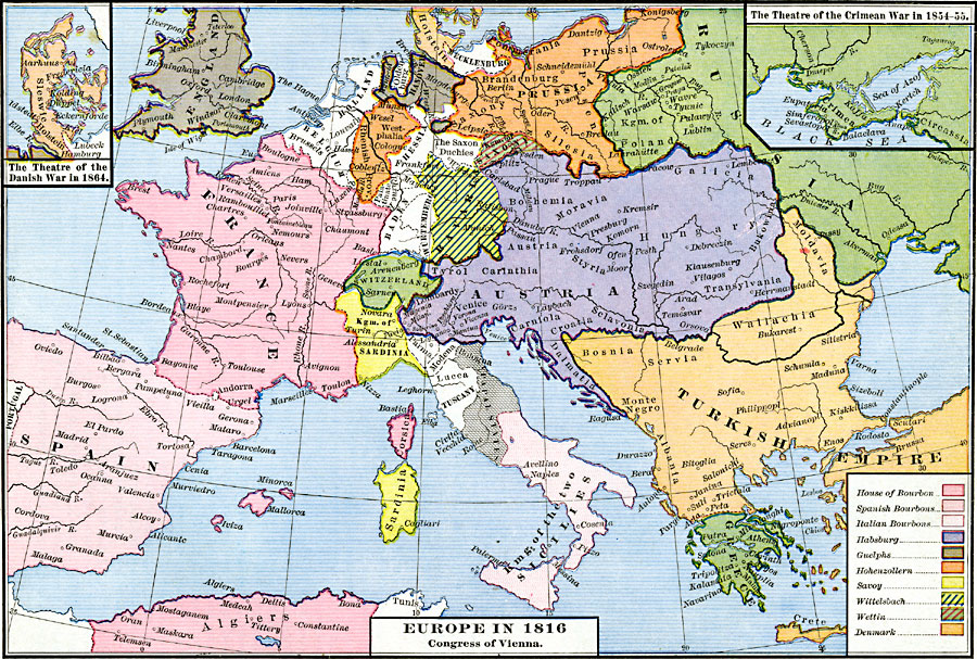
Description: A map of Europe in 1816, subtitled "Congress of Vienna." The map is color–coded to show the possessions of the various royal houses, including the House of Bourbon, Spanish Bourbons, Italian Bourbons, Habsburg, Guelphs, Hohenzollern, Savoy, Wittelsbach, Wettin, and Denmark. The map also shows the boundaries of Holland, Belgium, Hessia, Baden, Würtemburg, Switzerland, Kingdom of Sardinia, Parma, Modena, Lucca, the Papal States, and the Kingdom of the Two Sicilies. Major rivers and important cities of the time are shown. Inset maps detail the theater of the Danish War in 1864, and the theater of the Crimean War in 1854–55.
Place Names: Western and Central Europe, Austria, �Bohemia, �Denmark, �Finland, �France, �Greece, �Hungary, �Prussia, �Russia, �Sweden, �Switzerland, �Saxony, �Turke
ISO Topic Categories: oceans,
location,
inlandWaters,
boundaries
Keywords: Europe, borders, �political, country borders, oceans,
location,
inlandWaters,
boundaries, Unknown, 1816
Source: Robert H. Labberton, New Historical Atlas and General History (New York, NY: Townsend MacCoun, 1886) Plate LI
Map Credit: Courtesy the private collection of Roy Winkelman |
|