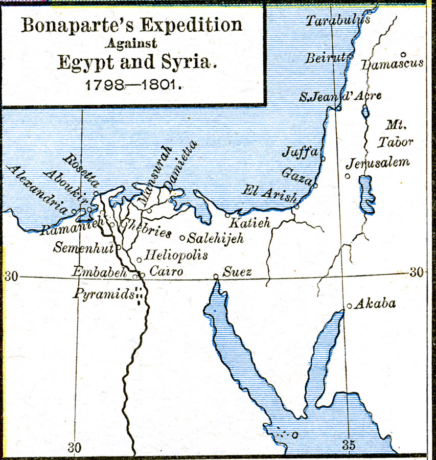
Description: A map of Napoleon Bonaparte's unsuccessful campaign into Egypt and Syria in 1798–1801. The purpose of the campaign was to protect French trade and hinder Britain's access to India through the Mediterranean.
Place Names: Egypt, Cairo, �Egypt, �Jerusalem, �Syri
ISO Topic Categories: oceans,
location,
inlandWaters
Keywords: Bonaparte's Expedition against Egypt and Syria, borders, �historical, kNapoleonBonaparte, other military, oceans,
location,
inlandWaters, Unknown, 1798–1801
Source: Robert H. Labberton, New Historical Atlas and General History (New York, NY: Townsend MacCoun, 1886) Plate L
Map Credit: Courtesy the private collection of Roy Winkelman |
|