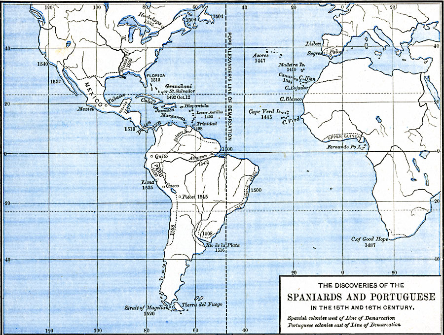
Description: Map shows the Discoveries of the Spaniards and Portuguese in the 15th and 16th Century.
Place Names: Regional Miscellaneous, Africa, �Europe, �North America, �South Americ
ISO Topic Categories: borders, �historical, kWorldAtlantic, kWorldAmericas, kWorldEuroAfrica
Keywords: The Discoveries of the Spaniards and Portuguese, borders, �historical, historical event, borders, �historical, kWorldAtlantic, kWorldAmericas, kWorldEuroAfrica, Unknown, 1492–1620
Source: Robert H. Labberton, New Historical Atlas and General History (New York, NY: Townsend MacCoun, ) Plate LVIII
Map Credit: Courtesy the private collection of Roy Winkelman |
|