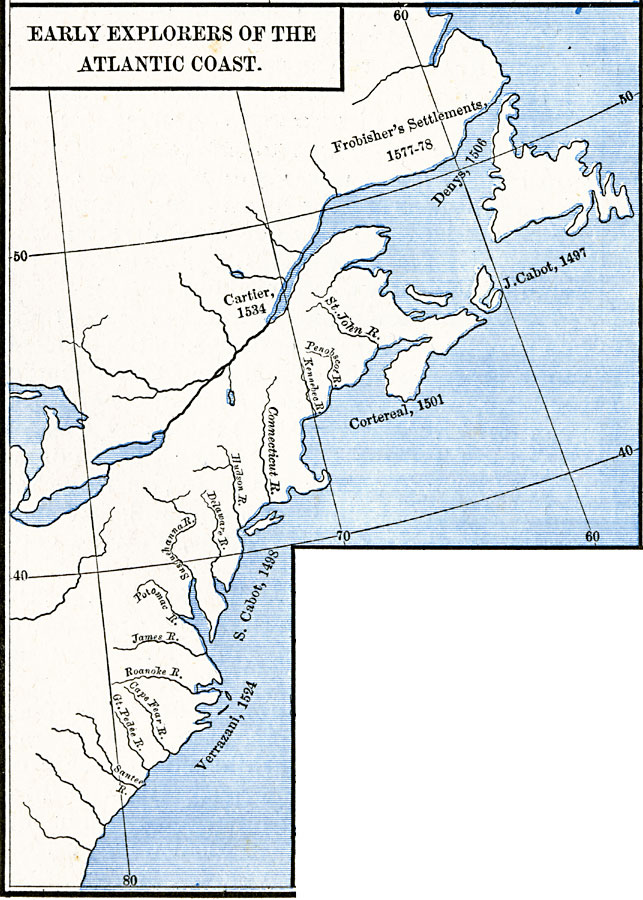
Description: A map of the Atlantic coast of North America from the Labrador Peninsula and Gulf of St. Lawrence south to the Santee River in the Carolinas, showing the European explorations and settlements in the region between 1492 and 1620. The map shows the areas explored by John Cabot (1497), Sebastian Cabot (1498), Gaspar Corte–Real (1501), John Denys (1506), Verrazani or Giovanni da Verrazzano (1524), Jacques Cartier (1537), and the Sir Martin Frobisher Settlements on the Gulf of St. Lawrence (1577–1578).
Place Names: A Regional Map of North America, Canada, �United State
ISO Topic Categories: oceans,
location,
inlandWaters
Keywords: Early Explorers of the Atlantic Coast, borders, �historical, historical event, oceans,
location,
inlandWaters, Unknown, 1492–1620
Source: Robert H. Labberton, New Historical Atlas and General History (New York, NY: Townsend MacCoun, 1886) Plate LIX
Map Credit: Courtesy the private collection of Roy Winkelman |
|