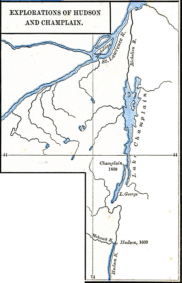
Description: A map of the region explored by Samuel de Champlain and Henry Hudson south of the St. Lawrence River in 1609. The map shows the area from the St. Lawrence down the Richenlieu south to Lake Champlain to the southernmost point reached by Champlain, and the area explored from the south by Hudson to the confluence of the Hudson River and Mohawk River.
Place Names: A Regional Map of North America, Canada, �United State
ISO Topic Categories: oceans,
location,
inlandWaters
Keywords: Explorations of Hudson and Champlain, borders, �historical, historical event, oceans,
location,
inlandWaters, Unknown, 1609
Source: Robert H. Labberton, New Historical Atlas and General History (New York, NY: Townsend MacCoun, 1886) Plate LIX
Map Credit: Courtesy the private collection of Roy Winkelman |
|