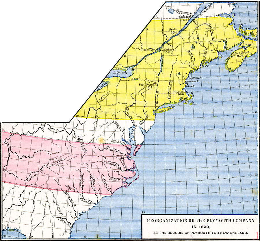
Description: A map of eastern North America in 1620 showing the King James Patent of the Plymouth Company to the north and London Company to the south. In 1620, the Plymouth Company was reorganized as the Plymouth Council for New England, or the Plymouth Colony. The map is color–coded to show the territory granted the London Company by King James I of England, and the expanded territory of the Plymouth Colony from latitude 40° N to the 48° latitude, which included New Brunswick and Nova Scotia. The map shows the rivers of the region, Fort Orange on the Hudson (1615), Plymouth (1620), and the French settlements along the St. Lawrence, including Hochelaga (1542), Tadousac (1534), Quebec (1608) and Port Royal (1604) in Nova Scotia.
Place Names: A Regional Map of North America, Canada, �United State
ISO Topic Categories: oceans,
location,
inlandWaters
Keywords: Reorganization of the Plymouth Company, borders, �historical, historical event, oceans,
location,
inlandWaters, Unknown, 1606–1620
Source: Robert H. Labberton, New Historical Atlas and General History (New York, NY: Townsend MacCoun, 1886) Plate LX
Map Credit: Courtesy the private collection of Roy Winkelman |
|