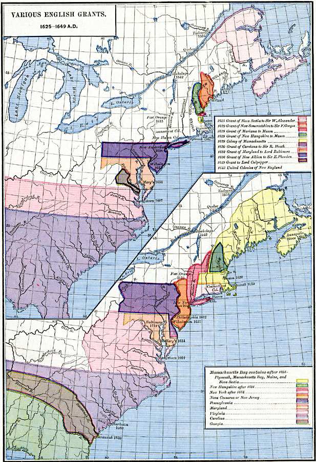
Description: A map of the east coast of North America showing the various British land grants after the Plymouth Company and London Company issued by King James in 1620. The map shows settlements and forts with dates of establishment given.
Place Names: A Regional Map of North America, Canada, �United State
ISO Topic Categories: oceans,
location,
inlandWaters
Keywords: Various English Grants in North America, borders, �historical, historical event, oceans,
location,
inlandWaters, Unknown, 1625–1733
Source: Robert H. Labberton, New Historical Atlas and General History (New York, NY: Townsend MacCoun, 1886) Plate LXI
Map Credit: Courtesy the private collection of Roy Winkelman |
|