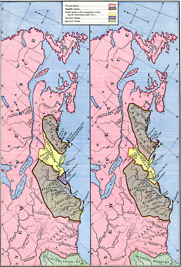
Description: A map of the eastern coast of North America showing territorial claims of Europeans and the development of the United Colonies of New England (New England Confederation) in 1643, and the territorial changes between the Dutch and British possessions after the First Dutch–Anglo War in Europe, and the Dutch incorporation of New Sweden into the New Netherlands in 1655. The map is color–coded to show the French possession in New France (Canada to French Florida), the Spanish territory in Florida, New Sweden along the Delaware River, New Netherlands, and the British territories in New England, Virginia, and Maryland. The map shows landing and settlement dates, and the original northern border of New Netherlands along the Connecticut River.
Place Names: A Regional Map of North America, Canada, �United State
ISO Topic Categories: oceans,
location,
inlandWaters
Keywords: Claims of Various European Countries to the US, borders, �historical, historical event, oceans,
location,
inlandWaters, Unknown, 1643–1655
Source: Robert H. Labberton, New Historical Atlas and General History (New York, NY: Townsend MacCoun, 1886) Plate LXII
Map Credit: Courtesy the private collection of Roy Winkelman |
|