mapsMaps ETC Site map
 Maps ETC > North America > A Regional Map of North America > The Country East of the Mississippi During the French-Indian War, 1763–1783
Site Map 

The Country East of the Mississippi During the French-Indian War, 1763–1783

The Country East of the Mississippi During the French-Indian War


Title: The Country East of the Mississippi During the French-Indian War
Projection: Unknown,
Source Bounding Coordinates:
W: -95 E: -65 N: 45 S: 25

Main Map Page
Zoomify Version
B/W PDF Version
Color PDF Version
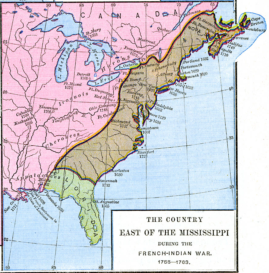
Description: The country east of the Mississippi during the French-Indian War, 1755—1763, color-coded to distinguish various claims to United States.
Place Names: A Regional Map of North America, Canada, United State
ISO Topic Categories: oceans, location, inlandWaters
Keywords: The Country East of the Mississippi During the French-Indian War, borders, oceans, location, inlandWaters, Unknown, 1763–1783
Source: Robert H. Labberton, New Historical Atlas and General History (New York, NY: Townsend MacCoun, 1886) Plate LXIV
Map Credit: Courtesy the private collection of Roy Winkelman
SearchLicensePDF HelpGIS Help Google Earth Help Zoomify Help

 Maps ETC > North America > A Regional Map of North America > The Country East of the Mississippi During the French-Indian War, 1763–1783
Site Map