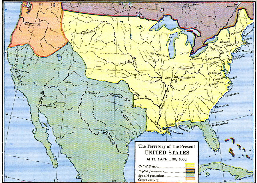
Description: A map of the United States in 1803 showing the extent of the territory after the Louisiana Purchase from France. The map is color–coded to show the possessions of the United States, Great Britain, and Spain at the time, and shows the extent of the Oregon Country.
Place Names: Growth of Nation, Georgia, �Maryland, �Massachusetts, �New Hampshire, �New Jersey, �New York, �North Carolina, �Pennsylvania, �Rhode Island, �Virginia,
ISO Topic Categories: oceans,
location,
inlandWaters
Keywords: The Territory of the United States, borders, oceans,
location,
inlandWaters, Unknown, After April 30, 1803
Source: Robert H. Labberton, New Historical Atlas and General History (New York, NY: Townsend MacCoun, 1886) Plate LXVII
Map Credit: Courtesy the private collection of Roy Winkelman |
|