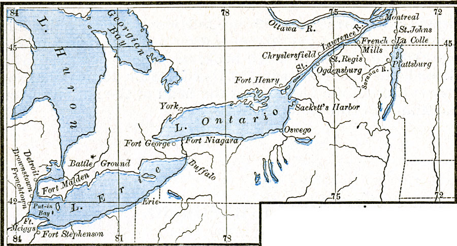
Description: A map of Lake Erie, Lake Ontario, and the St. Lawrence River to Montreal detailing the northern battle sites of the War of 1812, including Detroit, the Battle of Thames River, Brownstown, Frenchtown, Ogdensburg, and Plattsburg on Lake Champlain. Forts in the region are also shown.
Place Names: A Regional Map of North America, Buffalo, �Canada, �Detroit, �Erie, �Michigan, �Montreal, �New York, �Oswego, �Pennsylvania, �United State
ISO Topic Categories: oceans,
location,
inlandWaters
Keywords: Northern Theater of the War of 1812, borders, �historical, other military, oceans,
location,
inlandWaters, Unknown, 1812–1814
Source: Robert H. Labberton, New Historical Atlas and General History (New York, NY: Townsend MacCoun, 1886) Plate LXVIII
Map Credit: Courtesy the private collection of Roy Winkelman |
|