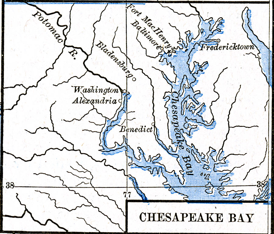
Description: A map of the upper Chesapeake Bay area showing important sites during the War of 1812, including the British landing site at Benedict on their campaign to capture Washington, the site of the Battle of Bladensburg, Washington, and Fort McHenry at the mouth of Baltimore Harbor.
Place Names: Growth of Nation, Alexandria, �Baltimore, �Benedict, �Fredericktown, �Maryland, �Virginia, �War of 1812, �Chesapeake Ba
ISO Topic Categories: oceans,
location,
inlandWaters
Keywords: Chesapeake Bay, borders, �historical, other military, oceans,
location,
inlandWaters, Unknown, 1813–1814
Source: Robert H. Labberton, New Historical Atlas and General History (New York, NY: Townsend MacCoun, 1886) Plate LXVIII
Map Credit: Courtesy the private collection of Roy Winkelman |
|