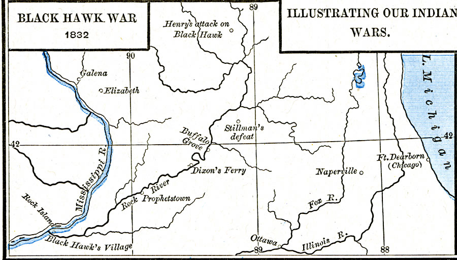
Description: A map of the Illinois and Michigan territory (present day Illinois and Wisconsin) showing the battle sites of the Black Hawk War of 1832. The map shows Black Hawk's Village (Saukenuk) near Rock Island on the Mississippi, Prophetstown, Dixon's Ferry, the site of Stillman's defeat, Buffalo Grove, Elizabeth (Battle of Apple River Fort), the site of General James Henry's attack on Black Hawk (Battle of Wisconsin Heights), Galena (near the site of the Bad Axe Massacre), and Fort Dearborn (Chicago).
Place Names: Growth of Nation, Chicago, �Elizabeth, �Galena, �Naperville, �Ottaw
ISO Topic Categories: oceans,
location,
inlandWaters
Keywords: Black Hawk War, borders, �historical, kNativeAmerican, other military, oceans,
location,
inlandWaters, Unknown, 1832
Source: Robert H. Labberton, New Historical Atlas and General History (New York, NY: Townsend MacCoun, 1886) Plate LXVIII
Map Credit: Courtesy the private collection of Roy Winkelman |
|