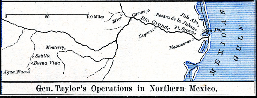
Description: A map of the area of the campaign of General Taylor during the Mexican–American War (1846–1848), showing the sites of Palo Alto, Resaca de la Palma, Fort Brown, Matamoras, Monterey, Saltillo, and Buena Vista.
Place Names: A Regional Map of North America, Agua Nueva, �Buena Vista, �Camargo, �Ft. Brown, �Matamoras, �Mexico, �Mier, �Monterey, �Palo Alto, �Resaca de la Palma, �Reynosa, �Saltillo, �United State
ISO Topic Categories: oceans,
location,
inlandWaters
Keywords: The Mexican War – Gen. Taylor's Operations in Northern Mexico, borders, �historical, �political, country borders, other military, oceans,
location,
inlandWaters, Unknown, 1846–1848
Source: Robert H. Labberton, New Historical Atlas and General History (New York, NY: Townsend MacCoun, 1886) Plate LXIX
Map Credit: Courtesy the private collection of Roy Winkelman |
|