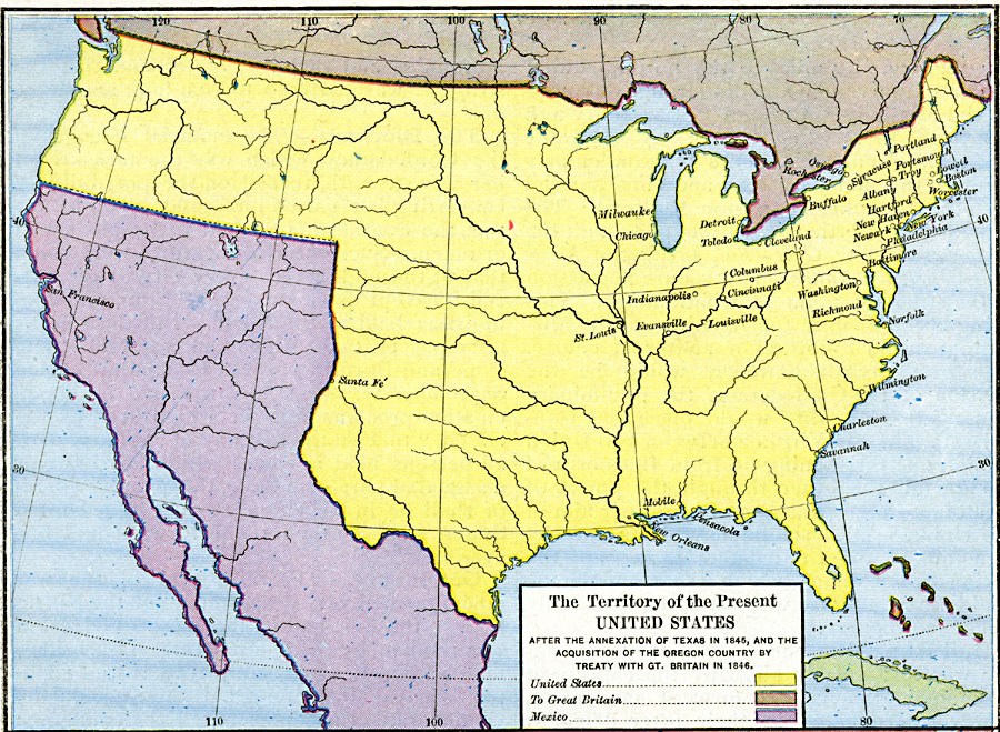
Description: A map showing the territory of the United States after the annexation of Texas in 1845, and the acquisition of the Oregon Country by treaty with Great Britain in 1846. The map is color–coded to show the possessions of the United States, Great Britain, and Mexico at the time.
Place Names: Growth of Nation, Albany, �Boston, �Chicago, �Mobile, �New Orleans, �New York, �Pensacola, �Portland, �Portsmouth, �San Francisco, �Santa Fe, �St. Louis, �Troy, �United States territory, �Great Britain territory, �Mexico territory, �Texas, �Oregon Countr
ISO Topic Categories: oceans,
location,
inlandWaters,
boundaries
Keywords: The Territory of the United States, borders, �political, country borders, oceans,
location,
inlandWaters,
boundaries, Unknown, 1846–1848
Source: Robert H. Labberton, New Historical Atlas and General History (New York, NY: Townsend MacCoun, 1886) Plate LXX
Map Credit: Courtesy the private collection of Roy Winkelman |
|