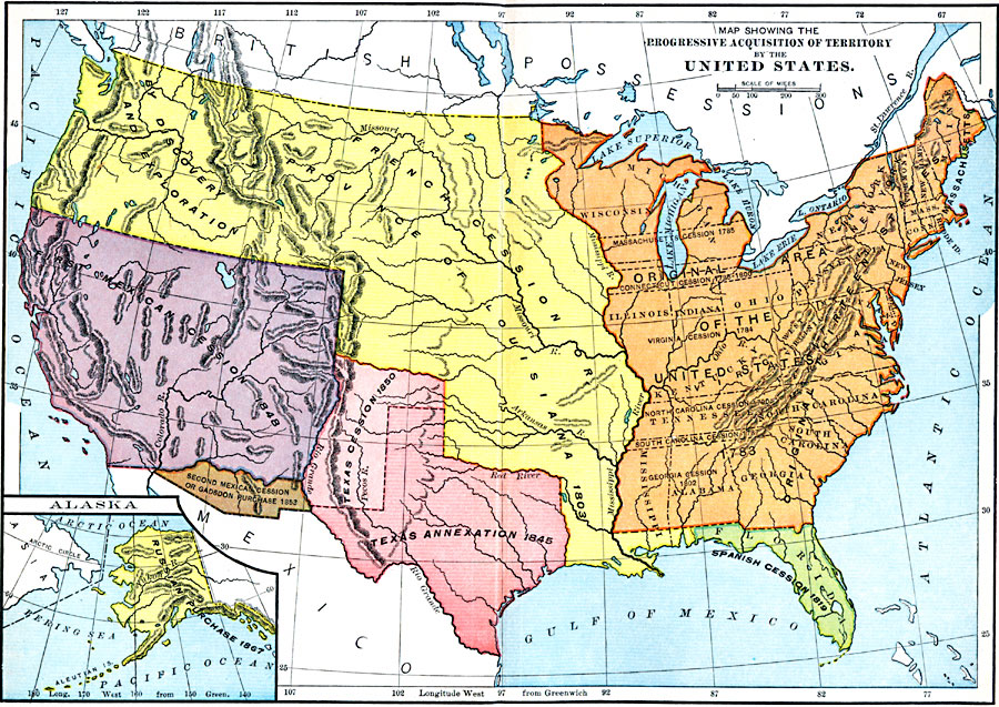
Description: A map from 1913 of the United States showing the territorial growth from the original States and the Northwest Territory in 1783 to the Russian cession of Alaska in 1867. The map is color–coded to show the progression from the original thirteen States and Northwest Territory, the French cession or Province of Louisiana including the Oregon Country by discovery and exploration in 1803, Spanish cession of Florida in 1819, Texas annexation in 1845 and cession in 1850, the first Mexican cession in 1848, second Mexican cession or Gadsden Purchase in 1853, and includes an inset map showing the Russian purchase in 1867.
Place Names: Growth of Nation, Florida, �Georgia, �South Carolina, �North Carolina, �Virginia, �Massachusetts, �Rhode Island, �Connecticut, �New Jersey, �New Hampshire, �Maine, �Vermont, �Pennsylvania, �Marylan
ISO Topic Categories: boundaries,
inlandWaters,
location,
oceans
Keywords: Acquisition of Territory, physical, �political, �historical, physical features, country borders,
major political subdivisions, boundaries,
inlandWaters,
location,
oceans, Unknown, 1783–1867
Source: E. Benjamin Andrews, History of the United States Vol II (New York, NY: Charles Scribner's Sons, 1913) 209
Map Credit: Courtesy the private collection of Roy Winkelman |
|