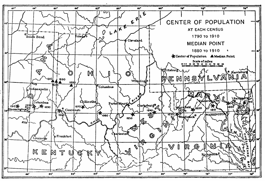
Description: A map from 1913 showing the mean center of population of the United States, calculated at each census from 1790 to 1910. The map illustrates the westward expansion of territory and migration during the period. The median point, that is, the point that divides the total population equally north to south and east to west, is given for the 1880 to 1910 census.
Place Names: Demographics, Washington D.C., �Charleston, �Annapolis, �Baltimore, �Richmond, �Columbus, �Indianapolis, �Virginia, �Kentucky, �Pennsylvania, �Ohio, ��populatio
ISO Topic Categories: inlandWaters,
location,
society
Keywords: Center of Population, physical, �political, �statistical, kPopulation, physical features, major political subdivisions, population, inlandWaters,
location,
society, Unknown, 1700–1910
Source: E. Benjamin Andrews, History of the United States Vol VI (New York, NY: Charles Scribner's Sons, 1913) 307
Map Credit: Courtesy the private collection of Roy Winkelman |
|