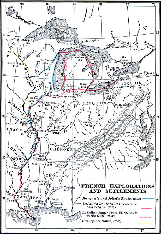
Description: A map of southern Canada, the Great Lakes region, and Mississippi River Valley to the Gulf of Mexico, showing the French explorations and settlements with dates given from between the establishment of Montreal by Champlain in 1611 to the establishment of St. Louis by Pierre Lacl&eagrave;de in 1764. The map shows the routes of exploration of Marquette and Joliet (1673), La Salle to Fort Crevecoeur and return (1679), La Salle from Fort St. Louis to the Gulf (1682), and Father Louis Hennepin (1680).
Place Names: A Regional Map of North America, Canada, �United State
ISO Topic Categories: inlandWaters,
location,
oceans,
transportation
Keywords: French Explorations and Settlements, physical, �political, �statistical, �transportation, �historical, physical features, major political subdivisions, ethnological, water routes, historical event, inlandWaters,
location,
oceans,
transportation, Unknown, 1611–1764
Source: Charles Kendall Adams, A History of the United States (Boston, MA: Allyn and Bacon, 1909) 73
Map Credit: Courtesy the private collection of Roy Winkelman |
|
