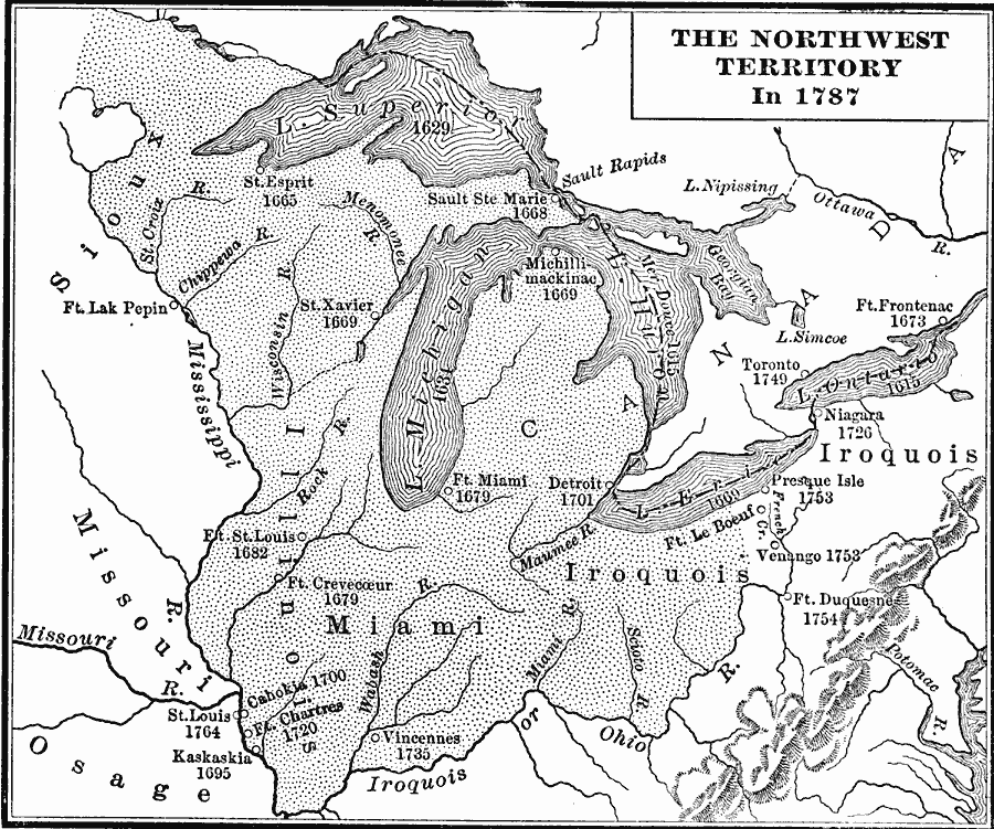
Description: A map of the Northwest Territory of the United States north of the Iroquois or Ohio River in 1787 showing early forts and settlements with dates of establishment given, rivers, and the general territories of the Illinois, Miami, and Iroquois groups.
Place Names: Growth of Nation,
ISO Topic Categories: boundaries,
inlandWaters,
location
Keywords: The Northwest Territory, physical, �political, �statistical, kNativeAmerican, physical features, major political subdivisions, ethnological, boundaries,
inlandWaters,
location, Unknown, 1787
Source: Charles Kendall Adams, A History of the United States (Boston, MA: Allyn and Bacon, 1909) 189
Map Credit: Courtesy the private collection of Roy Winkelman |
|