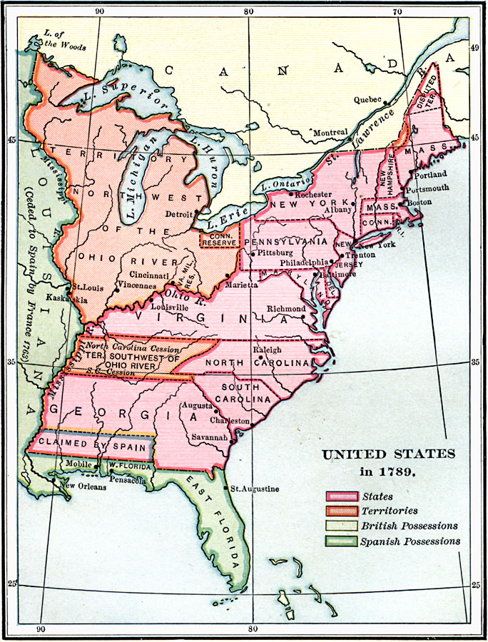
Description: A map of the United States in 1789, showing the State territorial claims, territories, and areas of territorial dispute. The map is color–coded to show States, territories, British possessions, and Spanish possessions, and shows the Northwest Territory north of the Ohio River, the State claims of Virginia, North Carolina, South Carolina, and Georgia from the Atlantic to the Mississippi River, the Connecticut Reserve, the disputed territory in northern Massachusetts (Maine) and southern Georgia, and the western lands ceded by North Carolina and South Carolina south of the Ohio River.
Place Names: Growth of Nation, New York, �New Orleans, �Boston, �Richmond, �Cincinnati, �St Louis, �Augusta, �Trenton, ��Spanish Territory, �Original Colonie
ISO Topic Categories: boundaries,
inlandWaters,
location,
oceans
Keywords: United States, physical, �political, physical features, country borders,
major political subdivisions, boundaries,
inlandWaters,
location,
oceans, Unknown, 1789
Source: Charles Kendall Adams, A History of the United States (Boston, MA: Allyn and Bacon, 1909) 191
Map Credit: Courtesy the private collection of Roy Winkelman |
|