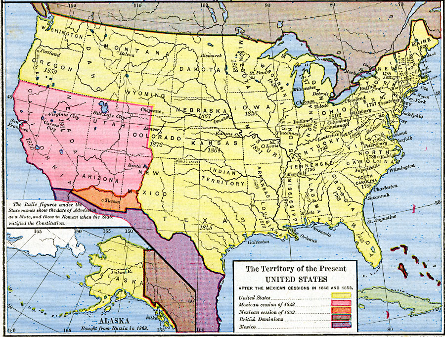
Description: A map from 1886 of the United States showing the territories ceded by Mexico and the acquisition of Alaska. The map is color–coded to show the possessions of the United States, Great Britain, and Mexico at the time, and the Mexican cession of California, Utah Territory, and New Mexico Territory in 1848, and the Mexican cession of 1853, also known as the Gadsden Purchase, south of the Gila River and west to the Rio Grande River. An inset map shows the territory purchased from Russia in 1868.
Place Names: Growth of Nation, Albany, �Bismarck, �Boston, �Carson City, �Cheyenne, �Chicago, �Denver, �Helena, �Las Vegas, �Mobile, �New Orleans, �New York, �Pensacola, �Portland, �Portsmouth, �Salt Lake City, �San Francisco, �Santa Fe, �St. Louis, �Troy, �Tucson, �First Mexican
ISO Topic Categories: oceans,
location,
inlandWaters,
boundaries
Keywords: The Territory of the United States, borders, �political, country borders, oceans,
location,
inlandWaters,
boundaries, Unknown, 1845–1886
Source: Robert H. Labberton, New Historical Atlas and General History (New York, NY: Townsend MacCoun, 1886) Plate LXX
Map Credit: Courtesy the private collection of Roy Winkelman |
|