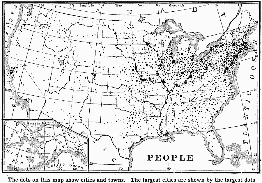
Description: A map from 1906 of the United States showing the general distribution of cities and towns at the time. The dots on this map show cities and towns, the largest cities are shown by the largest dots. — Frye's First Steps in Geography, 1906.
Place Names: Demographics, New York, �Pennsylvania, �Ohio, �Indiana, �Illinois, �Louisiana, �California, �Alaska, ��populatio
ISO Topic Categories: society,
inlandWaters,
oceans,
location
Keywords: United States City Distributions, physical, �statistical, kPopulation, physical features, population, society,
inlandWaters,
oceans,
location, Unknown, 1906
Source: Alexis Everett Frye, Frye's First Steps in Geography (Boston, MA: Ginn and Company, 1906) 54
Map Credit: Courtesy the private collection of Roy Winkelman |
|