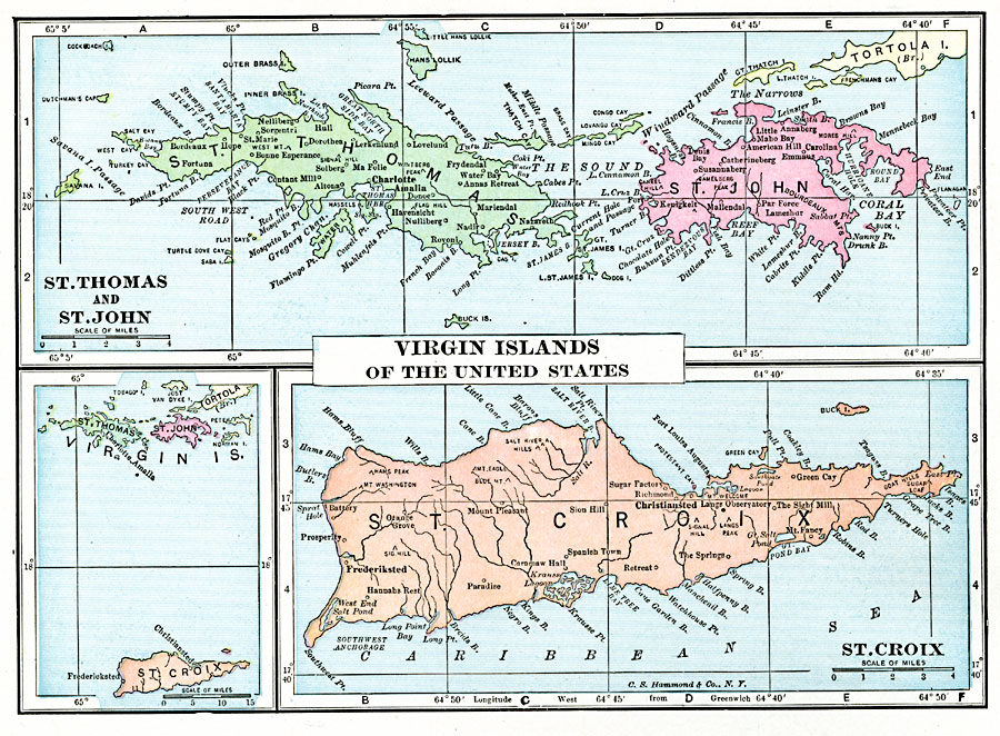
Description: A map from 1920 of the Virgin Islands of the United States.
Place Names: Virgin Islands, St. Croix, �St. John, �St. Thomas, �Charlotte Amalie, �Christiansted, �Cruz Bay, �Port Alucroi
ISO Topic Categories: oceans,
location,
inlandWaters
Keywords: Virgin Islands of the United States , borders, �political, kCaribbean, country borders,
county borders, oceans,
location,
inlandWaters, Unknown, 1920
Source: , The New Reference Atlas of the World - A New Series of Physical, Political and Historical Maps compiled from Government Surveys and exhibiting the Latest Results of Geographical Research (New York, NY: C. S. Hammond & Company, 1920) 16
Map Credit: Courtesy the private collection of Roy Winkelman |
|