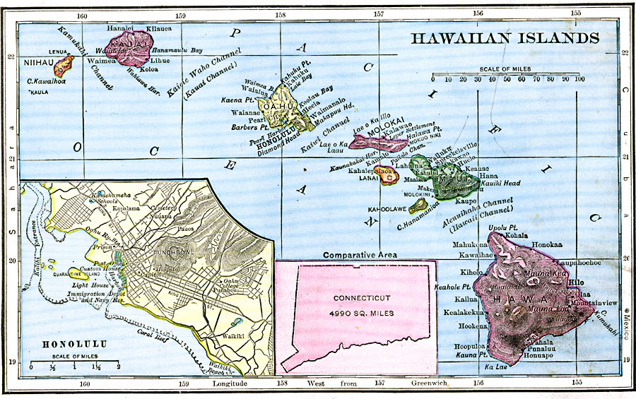
Description: A map from 1906 of the Hawaiian Islands showing the main islands of Hawaii, Maui, Kahoolawe, Lanai, Molokai, Oahu, Kauai and Niihau, cities, towns, ports, volcanoes, terrain, and coastal features. The inset map shows the western islands of Kauai and Niihau. An outline map of Connecticut at the same map scale shows comparative area size.
Place Names: Hawaii, Honolulu, �Hilo, �Hana, �Waimea, �Pearl Cit
ISO Topic Categories: location,
oceans
Keywords: Hawaiian Islands, physical, kComparativeArea, physical features, location,
oceans, Unknown, 1906
Source: Alexis Everett Frye, Frye's First Steps in Geography (Boston, MA: Ginn and Company, 1906) 67
Map Credit: Courtesy the private collection of Roy Winkelman |
|