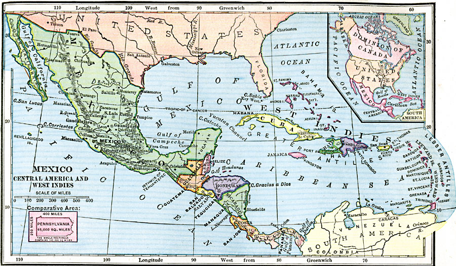
Description: A map from 1906 of Mexico, Central America, and the West Indies showing the political boundaries at the time, capitals and major cities, mountain systems, coastal features, and islands of the region. An inset map shows the entire North American region, including Greenland, Dominion of Canada, and the United States. An outline of Pennsylvania at the same map scale shows relative area size.
Place Names: A Regional Map of North America, Bahamas, �Cuba, �Mexico, �Guatemala, �Honudras, �Salvador, �Nicaragua, �Costa Rica, �Panama, �Jamaica, �Haiti, �Porto Rico, �Lesser antilles, �Leeward Islands, �Windward Islands
ISO Topic Categories: boundaries,
location,
inlandWaters,
oceans
Keywords: Mexico, Central America, and the West Indies, physical, �political, kCaribbean, kCentralAmerica, kComparativeArea, physical features, country borders, boundaries,
location,
inlandWaters,
oceans, Unknown, 1906
Source: Alexis Everett Frye, Frye's First Steps in Geography (Boston, MA: Ginn and Company, 1906) 71
Map Credit: Courtesy the private collection of Roy Winkelman |
|