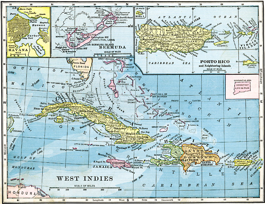
Description: A map from 1906 of the Greater Antilles and Bahama Island group of the West Indies. The map shows capitals, major cities, and ports, terrain and coastal features, submerged banks or reefs, and smaller islands. The water depths are indicated by the darkness of color, with 1,000 fathoms or less in light blue, and 2,000 fathoms or more in dark blue. Inset maps detail Havana and Havana Harbor, Bermuda (or Hamilton) Island, and Puerto Rico with the Virgin Islands. An outline map of Connecticut at the same map scale shows comparative area sizes.
Place Names: A Regional Map of North America, Bahamas, �Cuba, �Porto Rico, �Bermuda, �Jamaica, �Haiti, �Santo Domingo,
ISO Topic Categories: boundaries,
inlandWaters,
location,
oceans
Keywords: West Indies, physical, �political, kCaribbean, kComparativeArea, physical features, country borders, boundaries,
inlandWaters,
location,
oceans, Unknown, 1906
Source: Alexis Everett Frye, Frye's First Steps in Geography (Boston, MA: Ginn and Company, 1906) 73
Map Credit: Courtesy the private collection of Roy Winkelman |
|