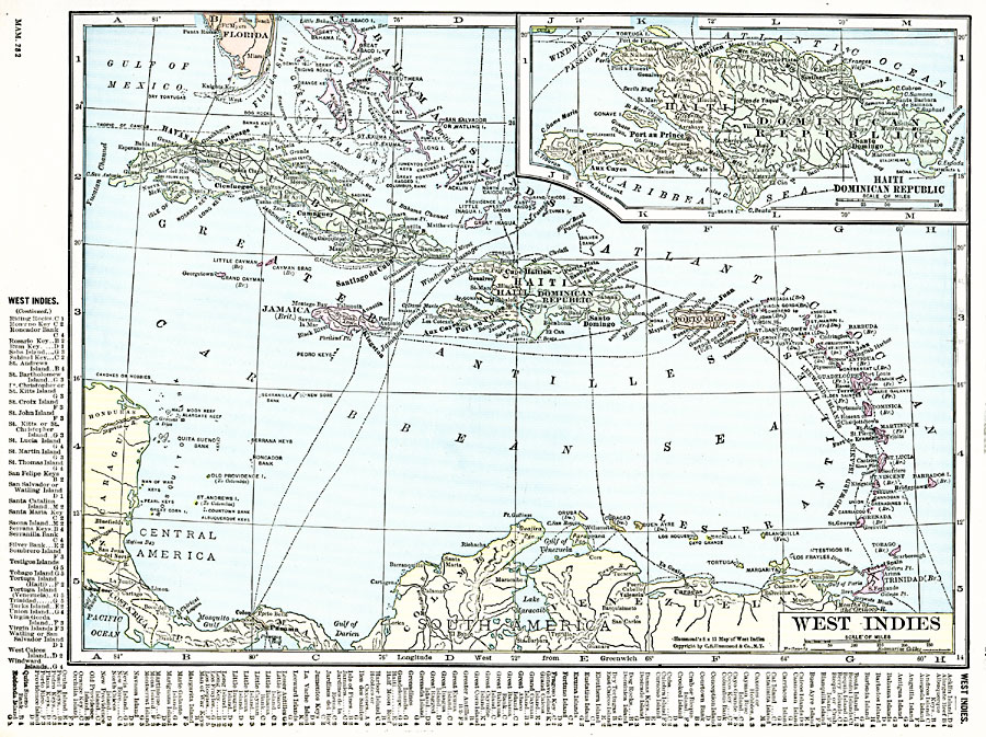
Description: A map from 1920 of the Greater and Lesser Antilles, and the Bahama Island group, showing capitals, major cities, towns and ports, railroads, submarine telegraph routes, terrain, and coastal features. The foreign possessions in the region are indicated in parentheses after the island name. An inset map details the island of Hispaniola, with the countries of Haiti and the Dominican Republic. A grid–key along the margins of the map help locate the islands in the region.
Place Names: A Regional Map of North America, Bahamas, �Cuba, �Havana, �Jamaica, �Kingston, �Matanzas, �Puerto Rico, �Port au Prince, �San Juan, �Santo Doming
ISO Topic Categories: oceans,
location,
inlandWaters
Keywords: West Indies, borders, �political, kCaribbean, country borders,
county borders, oceans,
location,
inlandWaters, Unknown, 1920
Source: , The New Reference Atlas of the World - A New Series of Physical, Political and Historical Maps compiled from Government Surveys and exhibiting the Latest Results of Geographical Research (New York, NY: C. S. Hammond & Company, 1920) 17
Map Credit: Courtesy the private collection of Roy Winkelman |
|