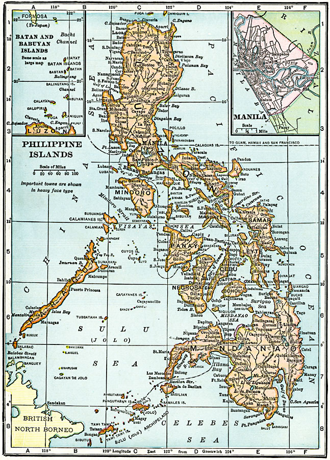
Description: A map from 1920 of the Philippine Islands from Luzon in the north to the Sulu (or Jolo) Archipelago in the south, and including the islands of Mindanao, Negrosa, Bohol, Cebu, Leyte, Panay, Samar, Paragua, Mindoro, and Luzon.. The map shows major cities, towns, and ports, railways, rivers, coastal features, and the principal steamship routes through the islands. Two inset maps detail the city and area around Manila, and the islands of Batan and Babuyan between Luzon and the Japanese possession of Formosa (Taiwan).
Place Names: Philippines, Bohol, �Cebu, �Leyte, �Luzon, �Manila, �Masbate, �Mindanao, �Mindoro, �Negros, �Panay, �Paragua, �Sama
ISO Topic Categories: oceans,
location,
inlandWaters
Keywords: Philippine Islands , borders, �political, country borders,
county borders, oceans,
location,
inlandWaters, Unknown, 1920
Source: , The New Reference Atlas of the World - A New Series of Physical, Political and Historical Maps compiled from Government Surveys and exhibiting the Latest Results of Geographical Research (New York, NY: C. S. Hammond & Company, 1920) 19
Map Credit: Courtesy the private collection of Roy Winkelman |
|