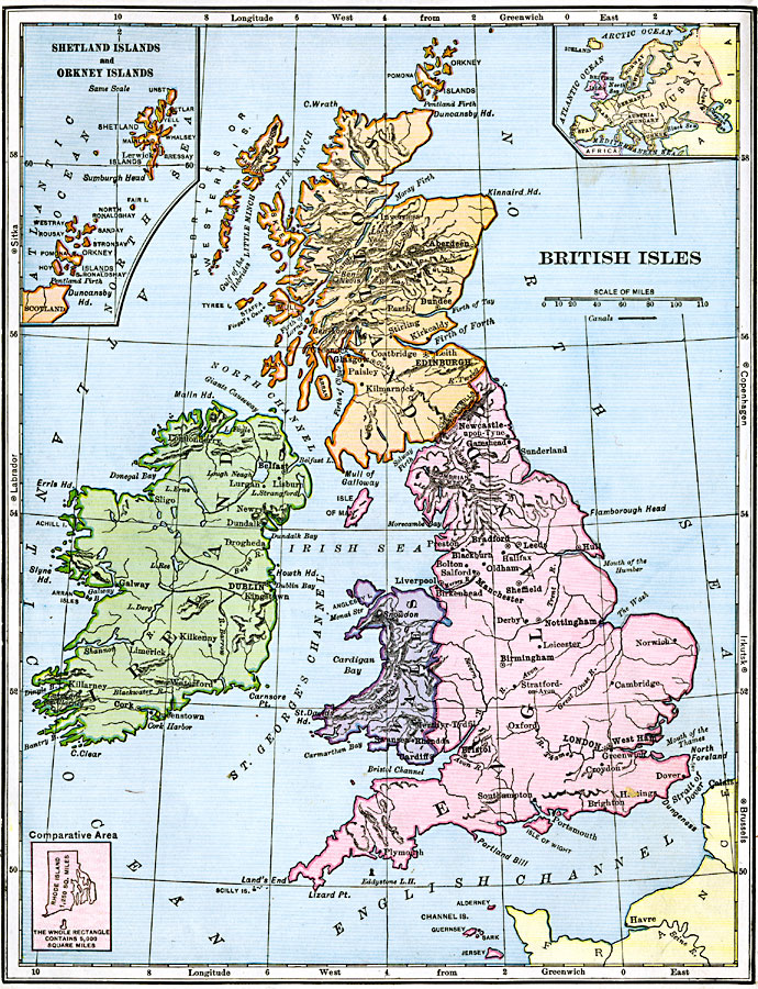
Description: A map of the British Isles from 1906, showing the terrain, rivers, and coastal features of Ireland, Scotland, England, and Wales. Major cities are shown, and the map includes an inset map of the Shetland and Orkney Islands, a locator map showing the relationship of the British Isles to Europe, and an outline map of Rhode Island at the same scale to show comparative sizes. Along the sides are latitude referenced to major cities in the eastern and western hemispheres.
Place Names: United Kingdom, Manchester, �London, �Londonderry, �Edinborough, �Glasgow, �Dundee, �Newcastle, �Plymouth, �Bristo
ISO Topic Categories: boundaries,
inlandWaters,
location,
oceans
Keywords: British Isles, physical, �political, physical features, country borders, other military, boundaries,
inlandWaters,
location,
oceans, Unknown, 1906
Source: Alexis Everett Frye, Frye's First Steps in Geography (Boston, Massachusetts: Ginn and Company, 1906) 92
Map Credit: Courtesy the private collection of Roy Winkelman |
|