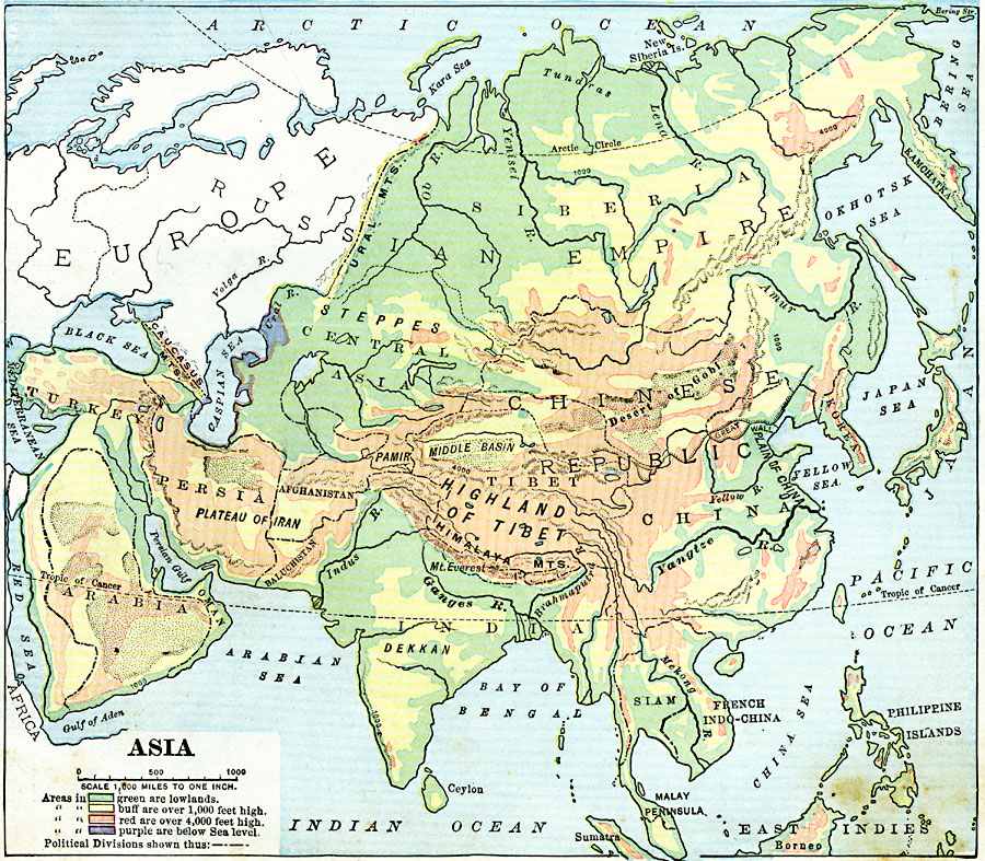
Description: A map from 1906 showing the general land elevations of Asia. This map is color-coded to show lands below sea level in purple, lowlands in green, areas above 1,000 feet above sea level in yellow-buff, and above 4,000 feet in red-buff. The map shows mountain systems, plateaus, deserts, rivers, coastal features, and land features, including the Plateau of Iran, Pamir, Highland of Tibet, Middle Basin, Desert of Gobi, Ural Mountains and the Himalaya Mountains. Political divisions of the time are shown.
Place Names: A Complete Map of Asia, India, �Japan, �Phillipines, �Russia, �China, �Siberia, �chinese Republic, �Siam, �French Indo-China, �Korea, �Afghanistan, �Persia, �Turkey, �Arabia, �Oman, �Baluchistan,
ISO Topic Categories: inlandWaters,
location,
oceans,
elevation
Keywords: Land Elevations of Asia, physical, physical features, inlandWaters,
location,
oceans,
elevation, Unknown, 1906
Source: Alexis Everett Frye, Frye's First Steps in Geography (Boston, MA: Ginn and Company, 1906) 105
Map Credit: Courtesy the private collection of Roy Winkelman |
|