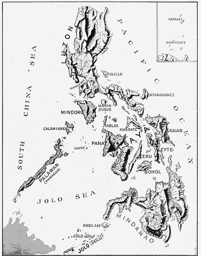
Description: A relief map from 1906 of the Philippine Islands showing the rugged terrain. "The raised map gives the names of the islands and shows the mountains, valleys, and rivers. The islands were largely built by volcanoes. The ranges run mostly north and south. There are many valleys, slopes, and plains with very deep and rich soil." &mdash, Frye, 1906, p. 116
Place Names: Philippines, Luzon, �Manila Bay, �Mindoro, �Palawan, �Panay, �Visayas, �Negros, �Mindanao, �Jolo, �Leyte,
ISO Topic Categories: location,
inlandWaters,
oceans
Keywords: Relief Map of the Philippine Islands, physical, kRelief, physical features, location,
inlandWaters,
oceans, Unknown, 1906
Source: Alexis Everett Frye, Frye's First Steps in Geography (Boston, MA: Ginn and Company, 1906) 117
Map Credit: Courtesy the private collection of Roy Winkelman |
|