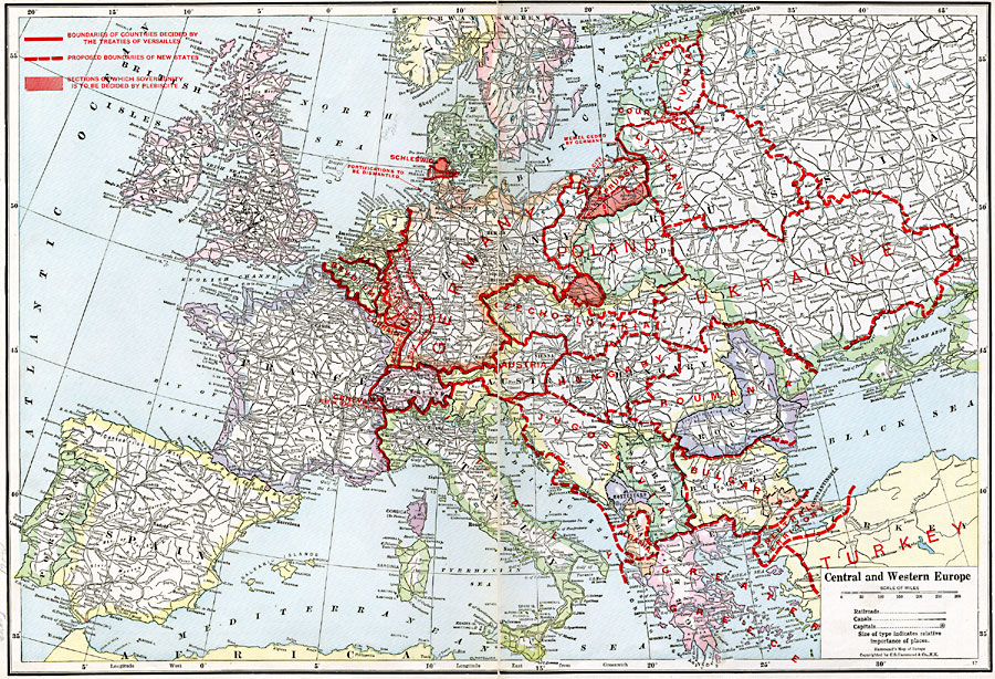
Description: Map of Central and Western Europe after the Treaty of Versailles at the end of WWI. The map includes railroads, canals, major cities and capitals, and the country boundaries established by the Treaties of Versailles, proposed boundaries of new states, and sections of which sovereignty is to be established by plebiscite. This map also includes the areas of fortification to be dismantled by the Germans, the Alsace–Lorraine territory and the neutral territory between the Aegean Sea and the Bosporus Straits.
Place Names: A Complete Map of Europe, France, �Germany, �Greece, �Italy, �Poland, �Portugal, �Romania, �Spain, �Sweden, �United Kingdo
ISO Topic Categories: oceans,
location,
inlandWaters,
boundaries
Keywords: Central and Western Europe, borders, �political, �historical, kTransportation, kVersailles, kWWI, country borders,
county borders,
major political subdivisions, historical event, oceans,
location,
inlandWaters,
boundaries, Unknown, 1920
Source: , The New Reference Atlas of the World - A New Series of Physical, Political and Historical Maps compiled from Government Surveys and exhibiting the Latest Results of Geographical Research (New York, NY: C. S. Hammond & Company, 1920) 34-35
Map Credit: Courtesy the private collection of Roy Winkelman |
|