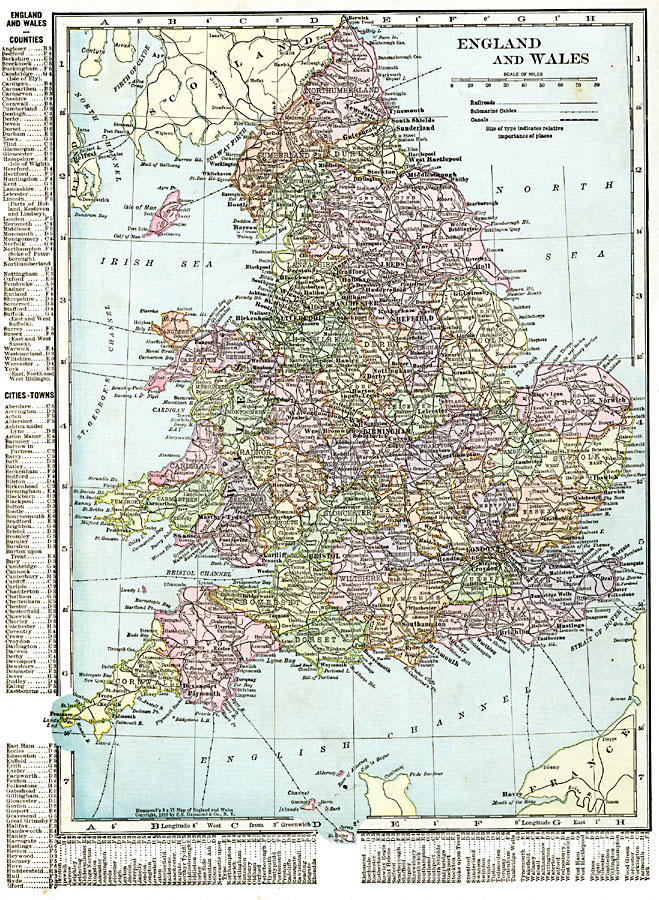
Description: A map of England and Wales in 1920 showing counties, cities, towns and ports, railways, canals and submarine cables. The map also shows rivers, mountains, and coastal features. This map also has a list of place names of counties, and principal cities and towns with location grid reference at the left edge and bottom of the map.
Place Names: United Kingdom, Birmingham, �Bristol, �Canterbury, �Derby, �England, �Essex, �Leeds, �Liverpool, �London, �Manchester, �Nottingham, �Plymouth, �Reading, �Sheffield, �Southampton, �United Kingdom, �Wale
ISO Topic Categories: oceans,
location,
inlandWaters,
boundaries
Keywords: England and Wales, borders, �political, �transportation, country borders,
major political subdivisions, railroads,
water routes, oceans,
location,
inlandWaters,
boundaries, Unknown, 1920
Source: , The New Reference Atlas of the World - A New Series of Physical, Political and Historical Maps compiled from Government Surveys and exhibiting the Latest Results of Geographical Research (New York, NY: C. S. Hammond & Company, 1920) 38
Map Credit: Courtesy the private collection of Roy Winkelman |
|