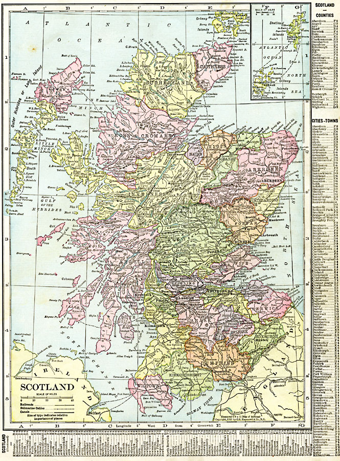
Description: A map of Scotland in 1920 showing counties, cities and towns, railroads, canals, submarine cable routes, rivers, mountain systems, and coastal features. The map includes an inset map of the northern Orkney Islands and Shetland, and has a grid–reference key to counties, cities, and towns.
Place Names: United Kingdom, Aberdeen, �Argyle, �Ayr, �Banff, �Berwick, �Caithness, �Cromarty, �Dumfries, �Dundee, �Edinburgh, �Elgin, �Glasgow, �Inverness, �Kincardine, �Kirkcudbright, �Perth, �Scotland, �Selkirk, �Sutherlan
ISO Topic Categories: oceans,
location,
inlandWaters,
boundaries
Keywords: Scotland, borders, �political, �transportation, country borders,
major political subdivisions, railroads,
water routes, oceans,
location,
inlandWaters,
boundaries, Unknown, 1920
Source: , The New Reference Atlas of the World - A New Series of Physical, Political and Historical Maps compiled from Government Surveys and exhibiting the Latest Results of Geographical Research (New York, NY: C. S. Hammond & Company, 1920) 39
Map Credit: Courtesy the private collection of Roy Winkelman |
|