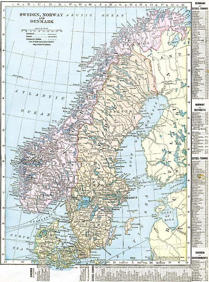
Description: A map of Sweden, Norway and Denmark in 1920, showing major cities, ports, and towns, railroads, canals, and submarine cables. There is a grid reference key to major cities and towns for the three countries, including governmental districts for Norway and Sweden, along the right–hand and bottom edge of the map.
Place Names: Scandinavia, Bergen, �Copenhagen, �Oslo, �Stockhol
ISO Topic Categories: oceans,
location,
inlandWaters,
boundaries
Keywords: Sweden, Norway, and Denmark, borders, �political, �transportation, �historical, major political subdivisions,
country borders, railroads,
water routes, other military, oceans,
location,
inlandWaters,
boundaries, Unknown, 1920
Source: , The New Reference Atlas of the World - A New Series of Physical, Political and Historical Maps compiled from Government Surveys and exhibiting the Latest Results of Geographical Research (New York, NY: C. S. Hammond & Company, 1920) 41
Map Credit: Courtesy the private collection of Roy Winkelman |
|