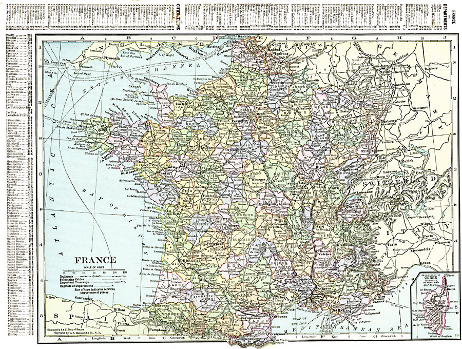
Description: A map of France in 1920, showing major cities and towns, rivers, railroads, canals, submarine cables, and important tramways. This map is color–coded to show the administrative Departments of France with their capitals circled. The map has a reference key to the Departments and major cities, and an inset map shows the French controlled island of Corsica.
Place Names: France, Bordeaux, �Dunkerque, �Grenoble, �Lyon, �Marseilles, �Nancy, �Nice, �Orleans, �Paris, �Starsbourg, �Toulouse, �Tour
ISO Topic Categories: oceans,
location,
inlandWaters
Keywords: France, borders, �political, �transportation, �historical, major political subdivisions,
county borders, railroads,
water routes, other military, oceans,
location,
inlandWaters, Unknown, 1920
Source: , The New Reference Atlas of the World - A New Series of Physical, Political and Historical Maps compiled from Government Surveys and exhibiting the Latest Results of Geographical Research (New York, NY: C. S. Hammond & Company, 1920) 42
Map Credit: Courtesy the private collection of Roy Winkelman |
|