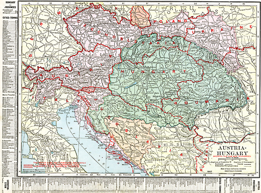
Description: A map of the former Austria–Hungary after the Treaty of Versailles following WWI, showing pre–war and post–war boundary changes. The map shows the new boundaries of Czechoslovakia and Jugoslavia, the losses to Poland, Ukraine, Romania, and Italy, and the post–war boundaries of Austria and Hungary. The broken lines are conjectural boundaries drawn along ethnographical lines, and shaded areas represent sovereignty to be decided by plebiscite. The boundary granting Italy a large portion of land along the Dalmatian Coast by the London Pact of 1915 is shown.
Place Names: Austria-Hungary, Budapest, �Gratz, �Innsbruck, �Vieena,
ISO Topic Categories: oceans,
location,
inlandWaters,
boundaries
Keywords: Austria and Hungary, borders, �political, �transportation, �historical, kWWI, major political subdivisions,
country borders, railroads,
water routes, other military, oceans,
location,
inlandWaters,
boundaries, Unknown, 1920
Source: , The New Reference Atlas of the World - A New Series of Physical, Political and Historical Maps compiled from Government Surveys and exhibiting the Latest Results of Geographical Research (New York, NY: C. S. Hammond & Company, 1920) 45
Map Credit: Courtesy the private collection of Roy Winkelman |
|