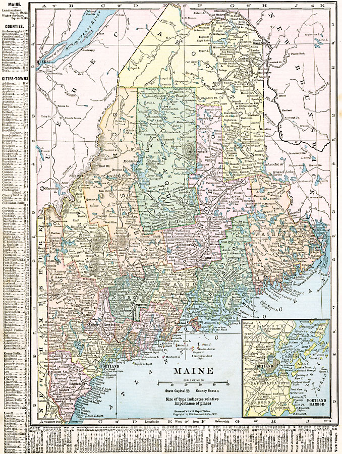
Description: A map from 1920 of Maine showing the State capital of Augusta, counties and county seats, major cities, towns and ports, railroads, mountains, lakes, rivers, and coastal features. An inset map details the vicinity of Portland. A grid reference in the margins of the map lists counties, principal cities, and towns of Maine.
Place Names: Maine, Augusta, �Bangor, �Belfast, �Biddeford, �Bucksport, �Dexter, �Ellsworth, �Lewiston, �Portland, �Princeton, �Whitneyvill
ISO Topic Categories: oceans,
location,
inlandWaters,
boundaries
Keywords: Maine, borders, �political, �physical, country borders,
county borders, oceans,
location,
inlandWaters,
boundaries, Unknown, 1920
Source: , The New Reference Atlas of the World - A New Series of Physical, Political and Historical Maps compiled from Government Surveys and exhibiting the Latest Results of Geographical Research (New York, NY: C. S. Hammond & Company, 1920) 64
Map Credit: Courtesy the private collection of Roy Winkelman |
|