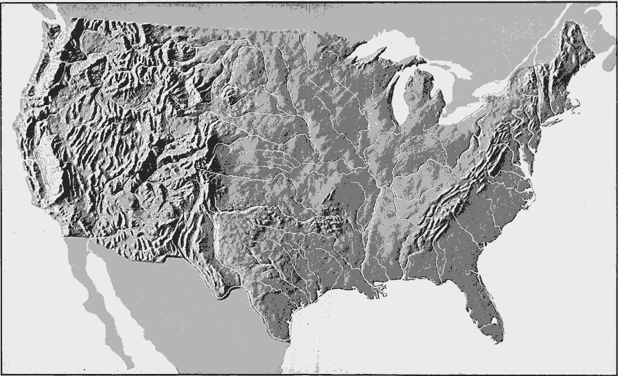
Description: A relief map from 1906 of the United States showing the mountain systems and highlands, plateaus, plains, lakes, rivers, and coastal features.
Place Names: A Complete Map of the United States,
ISO Topic Categories: inlandWaters
Keywords: Relief of the United States, physical, kRelief, physical features, inlandWaters, Unknown, 1906
Source: Alexis Everett Frye, Frye's First Steps in Geography (Boston, MA: Ginn and Company, 1906) 140-141
Map Credit: Courtesy the private collection of Roy Winkelman |
|