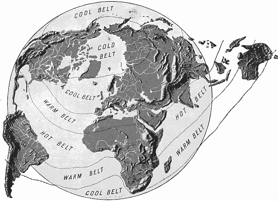
Description: A global map from 1904 showing the four temperature belts of the earth. The map shows the landmasses in relief, highlighting mountain and river systems.
Place Names: A Complete Map of Globes and Multi-continent, Africa, �Asia, �Australia, �Europe, �North Americ
ISO Topic Categories: location,
inlandWaters,
oceans,
climatologyMeteorologyAtmosphere
Keywords: Global Temperature Belts, physical, �meteorological, physical features, climate, location,
inlandWaters,
oceans,
climatologyMeteorologyAtmosphere, Unknown, 1904
Source: Alexis Everett Frye, Elements of Geography (Boston, Massachusetts: Ginn and Company, 1904) 33
Map Credit: Courtesy the private collection of Roy Winkelman |
|