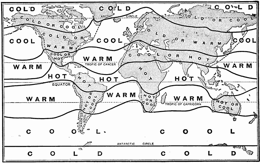
Description: World map with heat belts and temperature indicators.
Place Names: A Complete Map of Globes and Multi-continent, Africa, �Antarctica, �Asia, �Australia, �Europe, �North America, �South Americ
ISO Topic Categories: climatologyMeteorologyAtmosphere,
inlandWaters,
location,
oceans
Keywords: Heat Belts and Seasons of the World, meteorological, climate,
temperature, climatologyMeteorologyAtmosphere,
inlandWaters,
location,
oceans, Unknown, 1904
Source: Alexis Everett Frye, Elements of Geography (Boston, Massachusetts: Ginn and Company, 1904) 33
Map Credit: Courtesy the private collection of Roy Winkelman |
|