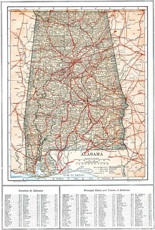
Description: A map of Alabama from 1914 showing the State capital of Montgomery, counties and county seats, major cities and towns, railroads, rivers, terrain features, and Mobil Bay. A grid reference at the bottom of the map lists counties and principal cities and towns.
Place Names: Alabama, Mobile, �Montgomery, �Huntsville, �Florence, �Birmingham, �Tuscaloosa, �Eufaula, �Selm
ISO Topic Categories: boundaries,
inlandWaters,
location,
transportation
Keywords: Alabama, physical, �political, �transportation, physical features, county borders, railroads, boundaries,
inlandWaters,
location,
transportation, Unknown, 1914
Source: , The New Encyclopedic Atlas and Gazetteer of the World (New York, NY: P. F. Collier and Son, 1914) 9
Map Credit: Courtesy the private collection of Roy Winkelman |
|