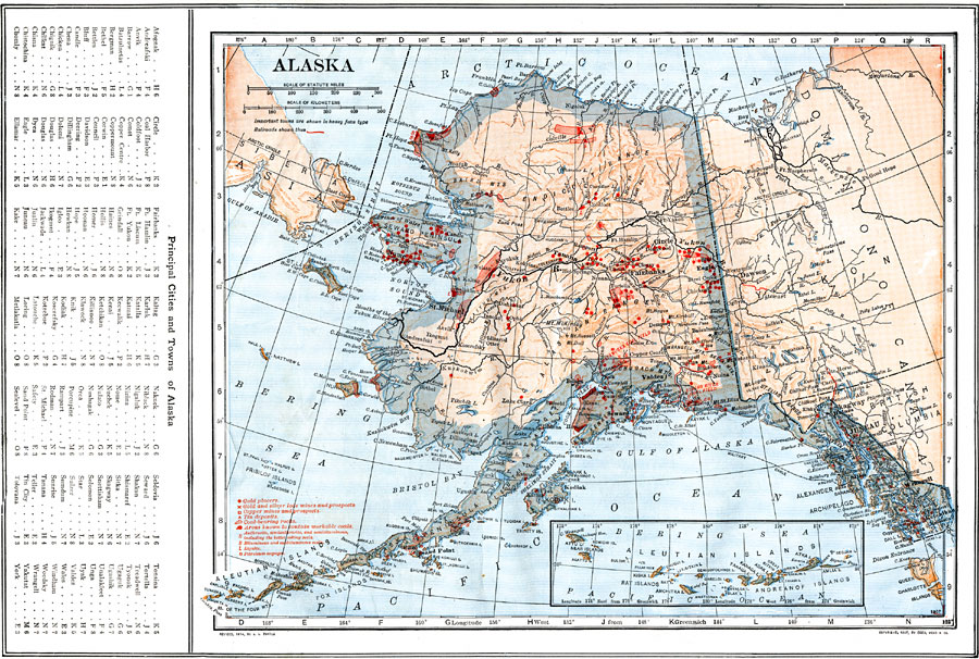
Description: A map of Alaska from 1914 showing the State capital at Juneau, cities, towns, ports, railroads, overland and submarine telegraph lines, mineral mines, major rivers and mountains, coastal features, and islands. A grid reference in the left margin of the map lists principal cities and towns.
Place Names: Alaska, Sitka, �Skagway, �Juneau, �Kodiak, �Kenai, �Nome, �Fairbank
ISO Topic Categories: boundaries,
inlandWaters,
location,
oceans,
transportation,
geoscientificInformation
Keywords: Alaska, physical, �political, �transportation, physical features, country borders, railroads, boundaries,
inlandWaters,
location,
oceans,
transportation,
geoscientificInformation, Unknown, 1914
Source: , The New Encyclopedic Atlas and Gazetteer of the World (New York, NY: P. F. Collier and Son, 1914) 10
Map Credit: Courtesy the private collection of Roy Winkelman |
|