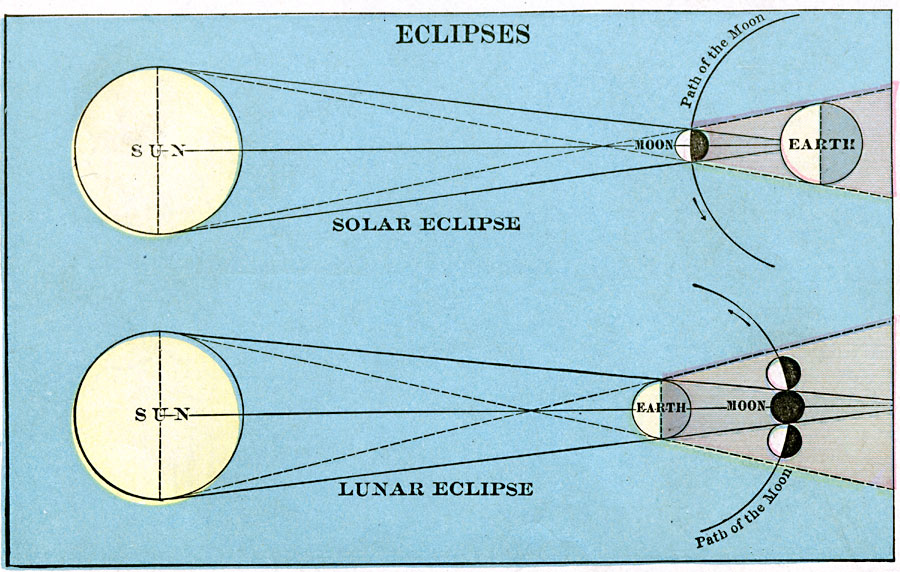
Description: Map shows path of the Moon during both lunar and solar eclipse.
Place Names: A Regional Map of Astronomical, Earth, �Moon, �Su
ISO Topic Categories: location
Keywords: Eclipses , position, �physical, �size, location, Unknown, 1920
Source: , The New Reference Atlas of the World - A New Series of Physical, Political and Historical Maps compiled from Government Surveys and exhibiting the Latest Results of Geographical Research (New York, NY: C. S. Hammond & Company, 1920) 128
Map Credit: Courtesy the private collection of Roy Winkelman |
|