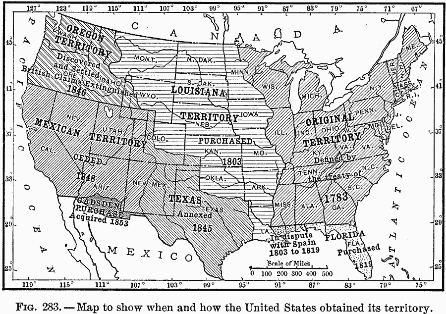
Description: A map of the United States showing its acquisition of territory from the original states and Northwest Territory after the American Revolutionary War in 1783 to the Gadsden Purchase in 1853.
Place Names: Growth of Nation, Florida, �Louisiana, �Mexican, �Oregon, �Texas, �Louisiana Purchase, �Mexican Cession, �Gadsden Purchase, �Oregon Country, �Original Colonies, �West Florid
ISO Topic Categories: oceans,
location,
inlandWaters
Keywords: How the United States Obtained its Territory, borders, �historical, country borders, historical event, oceans,
location,
inlandWaters, Unknown, 1783–1853
Source: Ralph S. Tarr, B.S., F.G.S.A. and Frank M. McMurry, Ph.D., New Geographies (Second Book) (New York , NY: The MacMillan Company, 1910) 197
Map Credit: Courtesy the private collection of Roy Winkelman |
|