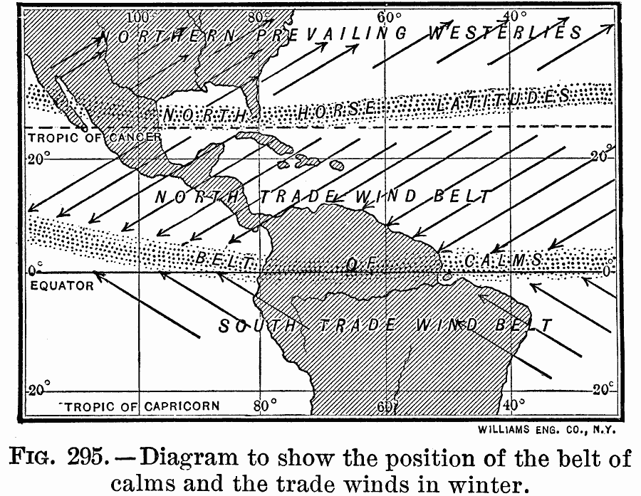
Description: A diagram of the tropics in the western hemisphere from 1910 showing the prevailing wind directions and the position of the trade winds belts and the belt of calms in the winter. This map covers the area from the Tropic of Capricorn in the south to approximately 40° N. beyond the Tropic of Cancer, and shows the northern prevailing Westerlies, the north horse latitudes, the north trade winds, the equatorial belt of calms, and the south trade winds.
Place Names: Regional Americas, North America, �South Americ
ISO Topic Categories: meteorological, kClimate, kWorldAmericas
Keywords: Trade Wind Belts in Winter, meteorological, kClimate, winds, meteorological, kClimate, kWorldAmericas, Unknown, 1910
Source: Ralph S. Tarr, B.S., F.G.S.A. and Frank M. McMurry, Ph.D., New Geographies (Second Book) (New York , NY: The MacMillan Company, 1910) 210
Map Credit: Courtesy the private collection of Roy Winkelman |
|