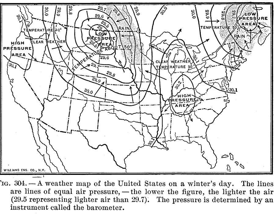
Description: A sample weather map from 1910 of the United States for a typical winter's day. The isobars are lines of equal air pressure, with the lower the figure the lighter the air. The pressure is determined by an instrument called the barometer.
Place Names: Meteorology, temperature, �barometric pressur
ISO Topic Categories: oceans,
location,
inlandWaters
Keywords: United States Weather on a Winter's Day, meteorological, kClimate, rainfall,
winds, oceans,
location,
inlandWaters, Unknown, 1910
Source: Ralph S. Tarr, B.S., F.G.S.A. and Frank M. McMurry, Ph.D., New Geographies (Second Book) (New York , NY: The MacMillan Company, 1910) 215
Map Credit: Courtesy the private collection of Roy Winkelman |
|